Friday, February 29, 2008

29/2 - Abel Tasman

Hi All,

The Abel Tasman Coast Track, located in Abel Tasman National Park on South Island’s northern shores. The Coast Track is consider to be one of the Great Walks in New Zealand and extends for 51km.
A good thing about this track is that it can be modified, we did only the first day walk as we found out the views often repeat themselves.

During that day we walked for about 21Km in 7.5 hours along the coast line, in the morning we booked for a water taxi which would take us to Bark bay and walked all the way back to Mahuru where we parked the car.


At first we didn't enjoy it very much, since we walked mostly in the bush without seeing the beaches and coast line which the trail follows, but at the second part of the day, we got to see some of the wonderful beaches this track has to offer, especially the one in Torrent Bay.


We found ourselves accelerate our paste since it became dark and there were a lot of km to go, so, although it suppose to be an easy flat track, at the end we were pretty exhausted.


The day after, we were happy to get a cloudy rainy weather, that gave us the opportunity to ease things up a little bit and have a rest day without feeling any guilty that we are waisting some unseen walking trails.

have fun,
Efrat and Yoni.

Thursday, February 28, 2008

28/2 - Nelson Lakes

Hi All,

Nelson Lakes national Park is on the way up to the north part of the south NZ island.
To start the day walks in this park, we drove to a little town called: "St.Arnaud", With the recommendation of DOC (Department of Conservation) employees, we did the Mt Robert circuit track.
The track starts with a nice and easy climbing for 1.5 hours combine walking in and out of the bush. the view were bird-looking on the lake Rotoiti and around St.Arnaud area.

The weather was super, as you know this is a main factor while going and hiking outside in New Zealand.


At the rest of the walk, we followed Mt Robert ridge and after 4 hours of easy stroll we descent to the car park, completing the circuit.


Sunset at nelson Lakes Area:


Have fun,
Efrat and Yoni.


Our Photo Album: http://picasaweb.google.com/yonifln
Our Movie Library: http://www.youtube.com/profile_videos?user=yonifln

Wednesday, February 27, 2008

27/2 - Punakaiki

Hi All,

This is just a short and accesible trip we did on the side of the main road, short but very popular as the tourist buses unloaded the many people to have a look and see.


The Pancake Rocks are a heavily eroded limestone area where the sea bursts though a number of vertical blowholes during high tides. Together with the 'pancake'-layering of the limestone (created by immense pressure on alternating hard and soft layers of marine creatures and plant sediments), these form the main attraction of the area.


Have fun,
Efrat and Yoni.


Our Photo Album: http://picasaweb.google.com/yonifln
Our Movie Library: http://www.youtube.com/profile_videos?user=yonifln

Tuesday, February 26, 2008

26/2 - Arthur's Pass

Hi All,

Many people have enjoyed this mountain-top trip offering panoramic views of the Southern mountains. However, some have met with tragedy because they did not realise the possible dangers of this route. This is an extremely steep and rocky journey to the top of an 1833-metre peak.
After the long tracks we did, this one was reasonable hard and challange.

The track climbs steeply through Mountain beech forest. In several places the track comes very close to Avalanche Creek and some stunning waterfalls.


Have fun,
Efrat and Yoni.


Our Photo Album: http://picasaweb.google.com/yonifln
Our Movie Library: http://www.youtube.com/profile_videos?user=yonifln

Monday, February 25, 2008

25/2 - Fox Glacier

Hi All,

After we passed the glacier because of the bad weather and after having interesting experienced taking 2 lifters (Omri who forgot his camera in our car and Ramona from Germany), we came back to the glacier and booked for the full day trip on the glacier itself.
Fox glacier is New Zealand's largest commercially guided glacier, situated in Glacier Country, on the West Coast of the South Island.
we left at 9:30 and came back at 17:00, we went through lots of lots of experience. just look at the photos and see what we mean:


Have Fun,
Efrat and Yoni.


Our Photo Album: http://picasaweb.google.com/yonifln
Our Movie Library: http://www.youtube.com/profile_videos?user=yonifln

Friday, February 22, 2008

22/2 - Wanaka

Hi All,
Wanaka is a town in the Central Otago region, It is the gateway to Mount Aspiring National Park, Wanaka is primarily a resort town but has both summer and winter seasons and is based around the many outdoor opportunities.

The rob Roy track we did was wonderful, it is 4 hours track go and come back, which looks out to the valley and the Rob Roi glacier.


Stuart Landsborough’s Puzzling World is a world unique attraction specialising in puzzling eccentricity, we paid a visit in this fun place.


the first of the world's modern-style mazes was great and the Illusion Rooms were something to look for, each room is an illusion in its own right.
in the Tilted House the room is tilted at an angle of fifteen degrees. All the displays inside are normal yet when you enter the room the illusion is so strong that your brain is convinced the room cannot be sloping.
we spent a few hours trying to solve the fun Puzzling games.


At Cinema Paradiso, we tryed the well famous home made cookie, which was so delicious.

Have fun,
Efrat and Yoni.


Our Photo Album: http://picasaweb.google.com/yonifln
Our Movie Library: http://www.youtube.com/profile_videos?user=yonifln

Wednesday, February 20, 2008

20/2 - Queenstown

Hi All,

Queenstown is considered as the capital city of Extreme sport of the world (Bungi jumping, skydiving, etc), as people proudly say here, since we arrived here after 2 long walking tracks, we decided to relax.
Generally, we didn't like this town since it's too commercial, and here it's all about the money. everything here cost you and cost you a lot, we decided eventually not to do the Bungi jumping and to save the 160 dollars for thriling 60 seconds or less.
we didn't spend much time here, the only nice thing we did, was a short walking trail to the Queenstown hill, and we got to re-unit with Adi which we have been traveling in Australia.


Have fun,
Efrat and Yoni.


Our Photo Album: http://picasaweb.google.com/yonifln
Our Movie Library: http://www.youtube.com/profile_videos?user=yonifln

Tuesday, February 19, 2008

18/2 - kepler Track

Hi All,

The Kepler Track, a 60 kilometre circular track, traverses through the spectacular scenery in the area, it took us 4 days to complete it.

The First day: 15 km , 6 hours
The track follows the lakeshore (Te Anau) through mountain and deep forrest, After 1.5 hours of walk, we reached a bay which called: Brod bay, here you can swim in a sunny day.
from here, the track to the bushline starts about halfway along the beach and climbs steadily for about 4 hours, this is the part that scares the most trampers, 4 hours of climbing (850 meters in altitude), but for us it was not that bad as we thought, at the end of the day we arrived to a beautiful hut, where you can see the other ridges and sounds.


The Second day: 14.6 km , 7 hours
The track in this day follows the high ridge, it consider to be the most beautiful day of the track, since you can see along the way the unique scenery of the fjords.
however, to enjoy this spectacular view, you have to have a good weather during this day, we didn't have much luck with the weather, some of the places were so cloudy that we couldn't see almost anything, although we were lucky enough to see some few wonderful fjords, when the fog got cleared once in a while.
at the last part of the day the way descends via a series of zigzags into a Hanging Valley. The track descends through forest, and provides a view of a large natural landslide.
for a nice side trip we headed up the valley for 20 minutes to Iris Burn Waterfall.


The third day: 16.2 km , 6.5 hours
A steady day’s tramp down through beech forest, riverside clearings and a gorge. The track climbs over a low saddle and wanders through mixed forest to the large slip formed during heavy rain in January 1984.
at the second part of the day we followed the lakeshore of Lake Manapouri and the ending point for us - moturau hut, situated beside a beautiful beach with panoramic views of Lake.


The Fourth day: 6 km , 1.5 hours
most of the day we walked in the bush, he track crosses a wetland and then the meandering Forest Burn just above its outlet into Balloon Loop, an old part of the River.
the ending point for Efrat was just a few minutes ahead in a place called Rainbow reach, from there she waited for Yoni with the big packs to bring the car. a lot of people finish this track at this point on the third day.
Yoni Continued for 9.5 km on the track along the river all the way back to te anau town and the car park.


have fun,
Efrat and Yoni.


Our Photo Album: http://picasaweb.google.com/yonifln
Our Movie Library: http://www.youtube.com/profile_videos?user=yonifln

Wednesday, February 13, 2008

14/2 - Te Anau

Te-Anau
Te Anau is a town in the South Island of New Zealand. It is on the eastern shore of Lake Te Anau in Fiordland, it is the gateway to a wilderness area famed for tramping and spectacular scenery - the last town passed through when travelling to Milford Sound.
because of it's location, this small town became a very touristic place.

Key Summit
The Key Summit track is an ideal introduction to the impressive scenery and natural features of Fiordland National Park.
it provides panoramic views over the Humboldt and Darran Mountains. During the last ice age, which ended about 14,000 years ago, a huge glacier flowed down the Hollyford Valley and overtopped Key Summit by 500 metres, with ice branches splitting off into the Eglinton and Greenstone Valleys.
to get there had had to climb for a few hundreds of meters, after Milford track, without the heavy pack, suddenly we felt like we can do it running backwards :) The weather was brilliant, it was very clear and sunny, therefore we stayed up in the summit for a longer time than we expected.


Gertrude Saddle
Here We tracked in a Glacier for 3 hours return enjoying the good weather with it's beautiful scenes and waterfalls


The Chasm
This is a 20 minute return walk where the watercourse disappears between a narrow chasm (as the name suggests). However, it's really more of a nature walk than it is a waterfall attraction because there's no safe way of seeing the waterfall satisfactorily. Instead, you get to look down at mostly strangely shaped rocks and potholes resulting from the Cleddau River's forceful flow as it gets channeled into the dark and narrow abyss.


Circle Track - Manapouri Lake
Another track we did between Milford and Kepler tracks, it's 8 km total, starting with a very steep climbing about 300 meters and looking on a great views on Manapouri Lake and area, the walk itself stretches along the bush Forrest. 4.5 hours of nice walk.


Tomorrow we're going to start the 4 days track called: Kepler, so wish us luck and -
Have fun,
Efrat and Yoni.


Our Photo Album: http://picasaweb.google.com/yonifln
Our Movie Library: http://www.youtube.com/profile_videos?user=yonifln

11/2 - Milford Track

Hi All,

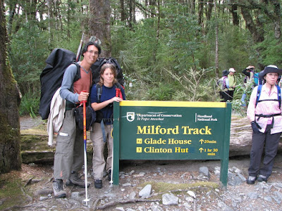
The Milford Track (53.5 kilometres) is in the heart of spectacular Fiordland National Park, Once described as the finest walk in the world, the Milford Track is one of New Zealand’s most popular walks (therefore you need to book it 6 month in advance like we did), with approximately 14000 people completing the Milford track each year.


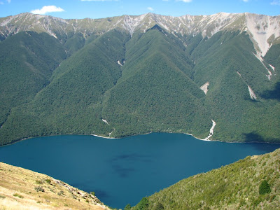
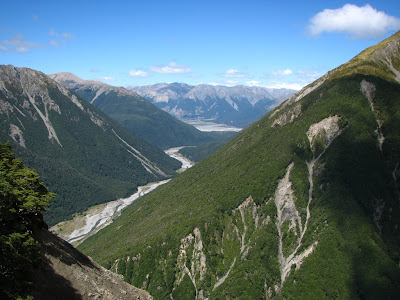
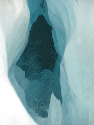
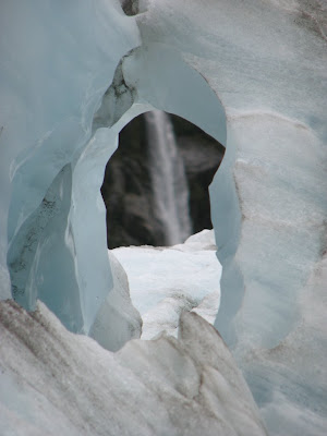
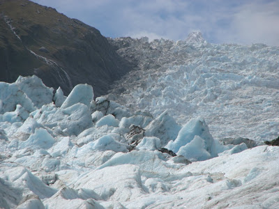
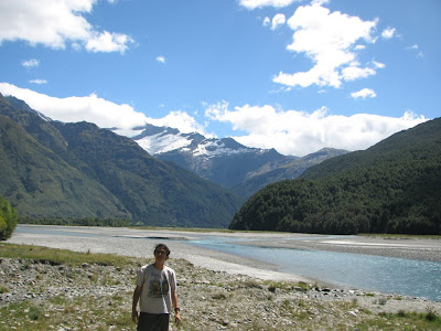
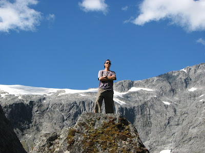
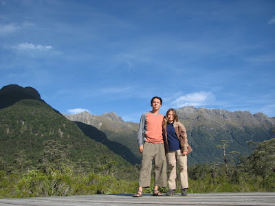
The huge valleys that we've see throughout the trek along the Milford Track are the result of glaciation over the last two million years, these glaciers carved there way through the landscape leaving behind these U-shaped valleys , ice-gouged ledges and the hanging valleys of tributary streams.

This track takes 4 days, at the first day we were sailing in a ferry which took us to the starting point of the track, from there we walked for 2 hours (5 KM) to our first hut - Clinton hut, there we spent our first night.


The second day: 16.5 KM , 7 hours
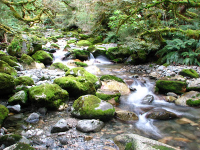
We gradual climbed from Clinton Hut as the track follows the Clinton River to its source, Lake Mintaro, at the base of Mackinnon Pass. It passes through sections of forest and crosses many streams, The track passes through many avalanche paths.
for Efrat this day was the hardest day, since it was her first time walking with the big heavy backpack (12Kg) on her for so many hours.


The Third day: 14 KM, 10 hours
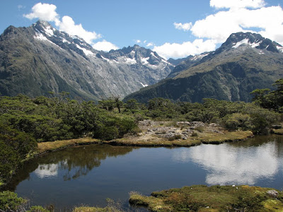
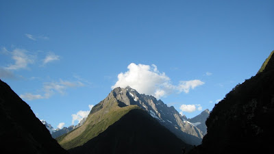
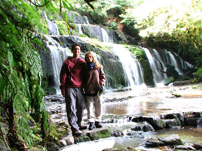
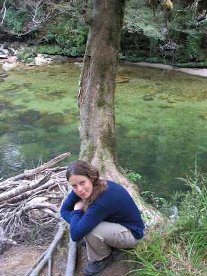
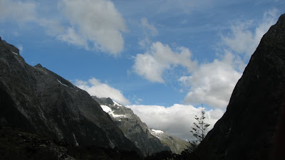
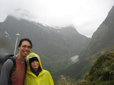
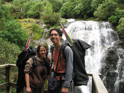
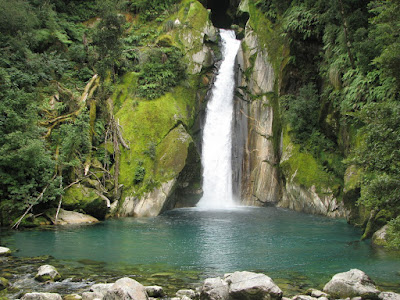
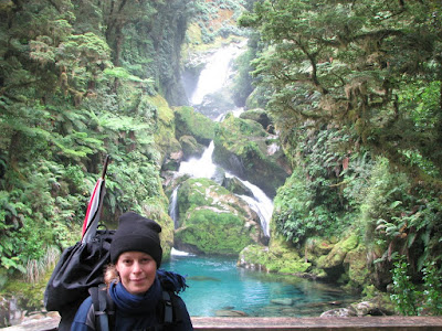
For This day starts with a well-graded, steady, zigzag climb of about 550 meters in altitude to the Mackinnon Pass, On the way there are excellent views of the lakes and Canyon, from there, the route drops 970 metres steadily over rocky, uneven terrain and provides spectacular views. The track follows the river, on which there are several waterfalls, every one of them is more beautiful than the other.
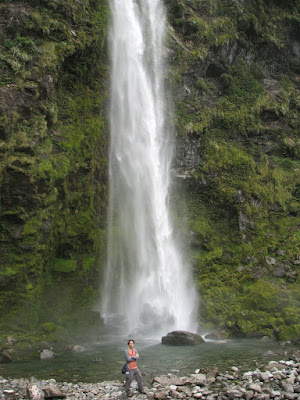
The side trip to the Sutherland Falls is well worth the effort, it is about 1½ hours return (6 km) to the highest waterfalls in New Zealand - 580 meters high. we did it without our packs which were left in a shelter.
For most of the people, this is the most difficult day in the track, but for Efrat it was easier than the day before, probably she got used for the heavy pack.


The Fourth day: 18 km, 6 hours
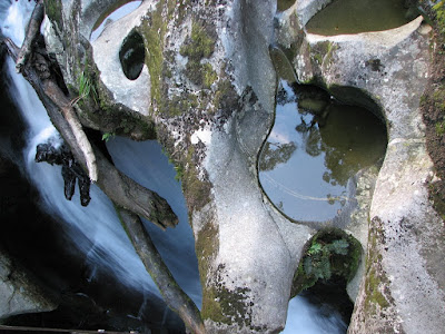
We don't know why, but for some reason, somebody decide that the transportation ferry from the end of the track to the main road will leave at 14:00 - so early in the day, that make all of us wake up early and walk very fast with out many stops, it was still beautiful to notice MacKay Falls and Bell Rock (intriguing rock, which has been worn by water and grinding stones and then tipped over in a rock fall), and to walk alongside the Arthur River and around Lake Ada.
Sandfly Point was our last and final stop for this walking track.
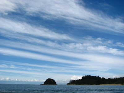
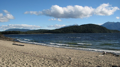
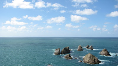
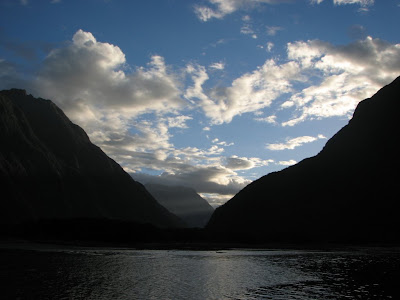
The ferry took us along Milford Sound - The so very impressive Fiord, probably the most touristic place in New Zealand.


The weather in this track was vary, in the first 2 days, it was sunny and nice, the following day (which considerably to be the most impressive day) unfortunately it changed to cold and rainy which caused a low visability. The last day it continued to have occasionally showers.


Have fun,
Efrat and Yoni.


Our Photo Album: http://picasaweb.google.com/yonifln
Our Movie Library: http://www.youtube.com/profile_videos?user=yonifln

5/2 - Invercargill

Hi All,

Invercargill is the biggest city in the south of New Zealand, although you still feel like in a small town, it is not so busy and the atmosphere there is pretty calm.
Over there we visited the Southland museum, a really nice Taotara is living there - a rare lizard which is one of a kind, this breed was living in the Dinosaur's era and it will continue to thrive as long as the humans won't hunt them for their precious leather.


"The world's Fastest Indian" of Burt Munro was the fastest vehicle in the world in 1930's, Hollywood made a nice movie out of this New Zealander story, we were able to see the real deal in a hardware store belong to Burt friend's children.


Efrat felt a little bit sick over there, so we decided to reduce our speed limit in our tour, we stayed at a really nice family - Ron and Rosalie which invited us to a nice dinner as well.


The Bluff is a the southern-most town in New Zealand and a seaport, it's about 30 km out of Invercargill and represent the first European setlment in New Zealand. at the hill over looking of the region we walked for about 1.5 hours in a bush walk and skyline.


Have fun,
Efrat and Yoni.


Our Photo Album: http://picasaweb.google.com/yonifln
Our Movie Library: http://www.youtube.com/profile_videos?user=yonifln

2/2 - The Catlins

Hi All,

The catlins situated off the beaten track on the southern-most coast of South Island in New Zealand, The Catlins is a major highlight of the Southern Scenic Route, There are so many choices of walking tracks and byways, we discovered the sometimes peaceful, sometimes savage treasures of The Catlins scenery.
It is a good area to spend a few days walking in the bush, along the beaches, and on the mountains, there are plenty of nice waterfalls here and other attractions.
Among all we've been up to, it worth to mension "Jack's blowhole" - a nice walk up on the grassy hills which look at the southern beaches, the hole is a 55 meters deep, 200 meters from the ocean, sea water get via underground tunnels to the hole and makes it more special.
Along the Catlins river we walked for 4 hours in the nice bush


In Canibal bay we have seen a sea lion


Among our wonderful trips in the area, we slept at Dick and Maryann's home which were so kind to host us, we felt like in a 5 stars hotel during our time there, the breakfast was super with home made cheese, bread, veg, etc.
we are very greatful for that.


Have fun,
Yoni and Efrat


Our Photo Album: http://picasaweb.google.com/yonifln
Our Movie Library: http://www.youtube.com/profile_videos?user=yonifln